Missouri River Commission Maps
History of the Missouri River Commission
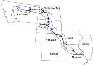
Congress created the Missouri River Commission (MRC) in, or shortly after,
1884, to accomplish a continuous, progressive development of the river.
The commission consisted of a five-member organization which was charged
to make surveys and devise plans to "maintain a channel and depth of
water ... sufficient for ... commerce" and to carry out plans of
improvement the commission deemed necessary. The commission went out of
existence in 1902. Source:
U.S. Army Corps of Engineers |
MRC Map Organization
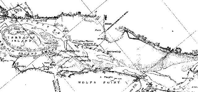
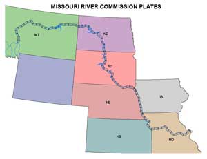
The MRC maps consist of 83 individual plates that are organized within 9 indexes. The original plates are identified by Roman numerals. For example Index
IV (4) includes Plates XXVIII-XXXVII (28-37).
Use the Index of MRC Map Plates
to determine which plates you wish to download then choose the file format that suits your needs based on the
descriptions below.
|
|
 |
MRC Map Formats
The MRC maps are available to download in two different formats for downloading:
1. Raster (TIF format)
These maps are UNPROJECTED black and white images. Each plate is 26" wide by and14" inches tall, 400 dpi resolution, and about 350 kb in size. They can be resized and reduced in resolution for insertion into printed documents.
2. Vector (ArcView 3.2 shapefiles)
Dr. David Miller, Department of Geography, SUNY Cortland, Cortland, NY converted the unprojected raster images of the map series to projected ArcView shapefiles.
The compressed vector files can be as large as 18MB. |
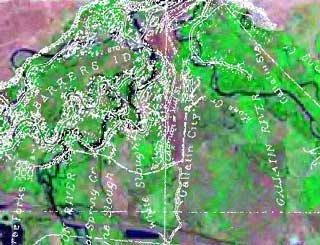
Map comparison over time
Landsat images are acquired from space. Dr. Miller initiated this work in order to visualize changes to the river system that have occurred over a 100-year period. This is accomplished by overlaying the MRC plates (1894) and Landsat 5 images (1990s) (example on right).
|
 |
URL: http://aa179.cr.usgs.gov/mrc.htm
Contact: Chris Henke
573-876-1884
Columbia Environmental Research Center
4200 New Haven Road, Columbia, MO 65201
|