| |

|
|
|
|
|
Specific tasks included:
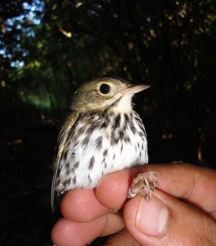
1) Build a contact database of fishing clubs, towns, rod and gun clubs, sporting groups, and other community organizations in the Project Area and reach out to them with a list of opportunities to participate in one or more elements of the Fish Lead Free program.
2) Schedule and deliver at least 8 programs about Common Loons and Fish Lead Free to contact groups in the . . . read more!
|
|
| |

|
|
|
|
|
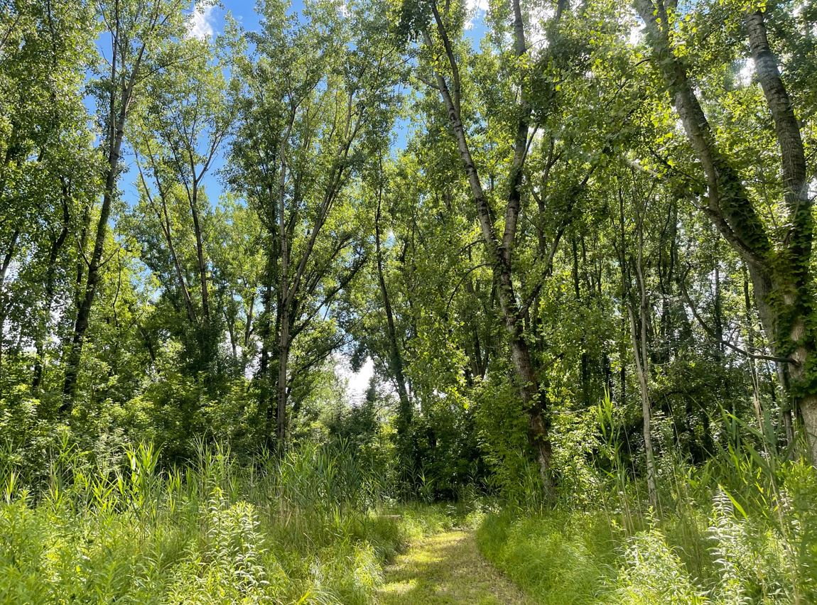
Protect and restore wintering habitat in Belize for migratory birds that breed in CT.
|
|
| |
|
|
|
|
|
In October 2012, the non-profit Belize Foundation for Research and Environmental Education (BFREE) initiated the Belize Cacao-based Agroforestry Restoration Program (BCARP) to convert agricultural land that had been degraded by slash-and-burn techniques to bird-friendly cacao-based agroforestry. Shade-grown cacao agroforestry benefits birds by creating layers of native vegetation similar to natura. . . read more!
|
|
| |
|
|
|
|
|
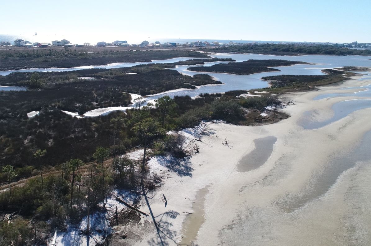
On July 28, 2023, approximately 73.43 acres were acquired on the Fort Morgan Peninsula in Alabama and incorporated into Bon Secour National Wildlife Refuge (BSNWR). The newly acquired land on Navy Cove was once the site of a settlement known as "Pilot Town". It was named for a community of bar pilots that helped ships navigate sandbars in Mobile Bay from the early 1800s until the town was destroye. . . read more!
|
|
| |

|
|
|
|
|
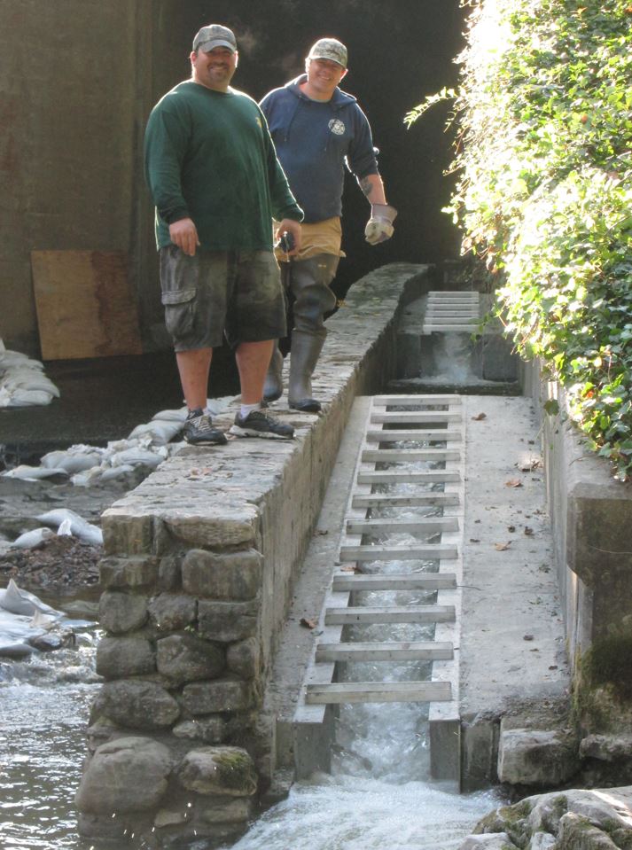
The Connecticut SubCouncil of the Housatonic River Natural Resource Trustees transferred $81,000 to the Housatonic Valley Association (HVA) to develop shovel-ready designs for the replacement of two barrier culverts on Pond Mountain Brook in Kent, CT. HVA partnered with Trout Unlimited (TU) to design two new open-bottom structures that will allow eastern brook trout and other native coldwater spec. . . read more!
|
|
| |
|
|
|
|
|
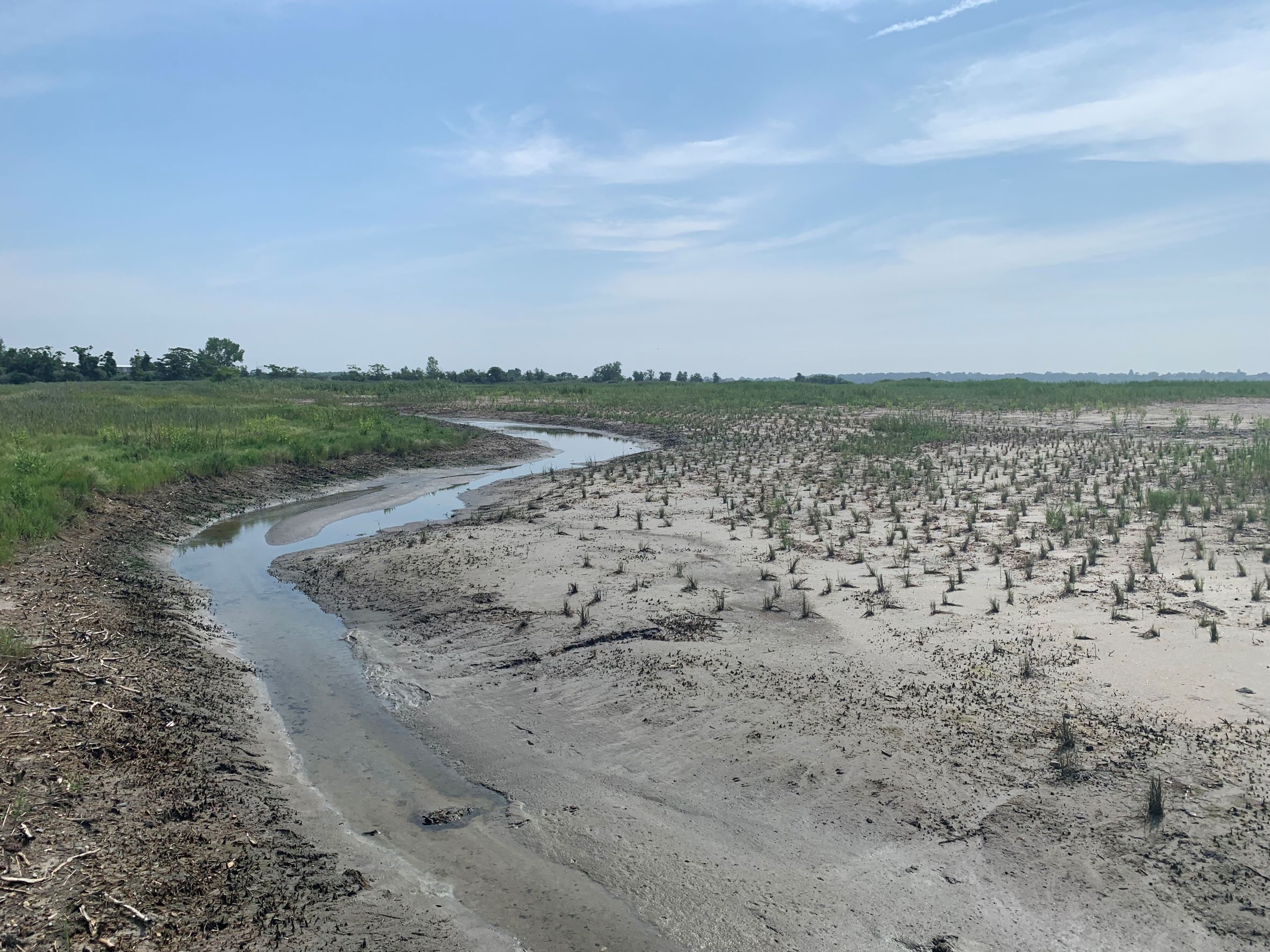
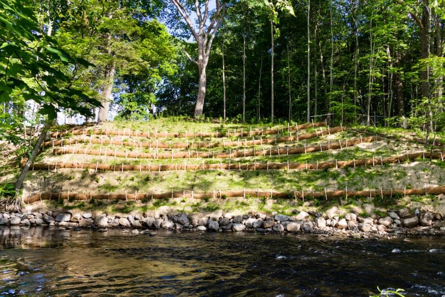
Great Meadows Marsh is one of Connecticut's most extensive remaining tidal salt marshes. Like many other marshes in the state, Great Meadows Marsh has been drastically altered since the 1700s. Originally extending over 1,400 acres, the marsh has decreased in size by over 50%. Portions of the marsh were drained by mosquito ditching and filled in with dredge spoils, leading to the spread of invasive. . . read more!
|
|
| |

|
|
|
|
|
The Moosup River currently supports one of the most important cold water fisheries within the Quinebaug River and the larger Thames River Basin as well as the State of Connecticut.The Moosup River originates in Rhode Island and flows south and then west through the Connecticut towns of Sterling and Plainfield where it meets the Quinebaug River. The 16 mile Moosup River is one of five main tributa. . . read more!
|
|
| |

|
|
|
|
|
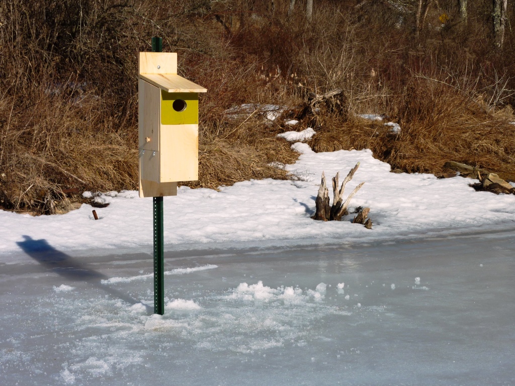
Engage local citizens in citizen science projects to educate townspeople and to promote the stewardship of natural resources.
Beginning in the spring of 2009, the program engaged Canterbury volunteers in five citizen science projects: Vernal Pool Survey, Grassland Bird Habitat Survey, Mammal Monitoring, and two
water quality projects: StreamWalk and Rapid Bioassessent in Wadeable Streams and R. . . read more!
|
|
| |
|
|
|
|
|
To compensate for injuries to natural resources, the Connecticut SubCouncil of the Housatonic River Natural Resource Trustees provided funding to improve waterfowl habitat and visitor access to the Carse Brook wetland system at the Emily Winthrop Miles Wildlife Sanctuary in Sharon, CT. Managed by Audubon Connecticut, a state office of the National Audubon Society, the approximately 100 acres of we. . . read more!
|
|
| |
|
|
|
|
|
To compensate for recreational use losses associated with the discharge of polychlorinated biphenyls (PCBs) into the Housatonic River from the General Electric (GE) Pittsfield Plant in Massachusetts, public access improvements were made around Ball Pond Brook in New Fairfield, CT. A new hiking trail with an Americans with Disabilities Act (ADA) accessible walkway and bridge over the brook was cons. . . read more!
|
|
| |
|
|
|
|
|
The Pomperaug River is a 13.4-mile-long tributary of the Housatonic River in southwestern Connecticut. The river is classified as Class B Surface Waters by the Connecticut Department of Energy and Environmental Protection (CT DEEP) with habitat for fish, aquatic life and wildlife, recreation, navigation, and industrial and agricultural water supply listed as its designated uses. Ballantine Park is. . . read more!
|
|
| |
|
|
|
|
|
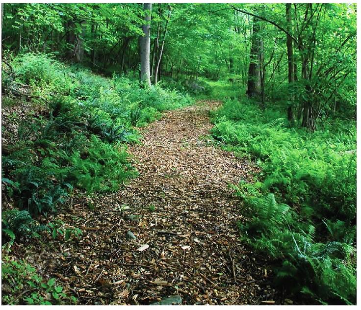
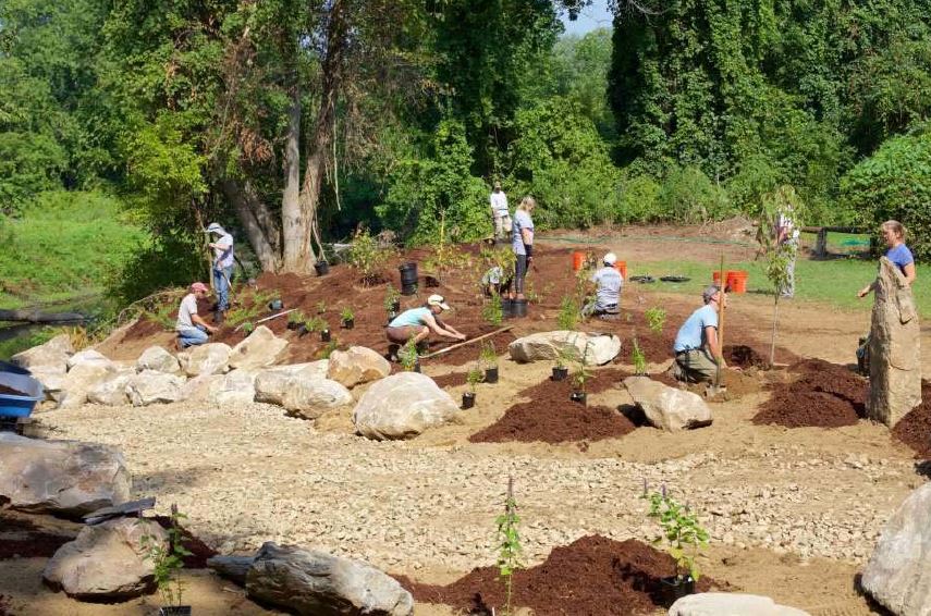
Riverbend Park is a small pocket park along the Naugatuck River in Beacon Falls, CT that is a popular access point for fishing, canoeing and kayaking. The park was originally a 1.5 acre parcel that opened to the public in 2001 but it doubled in size by the mid 2010s after the town acquired several adjacent properties to expand the park. In 2014, the Town of Beacon Falls received $100,000 from the . . . read more!
|
|
| |
|
|
|
|
|
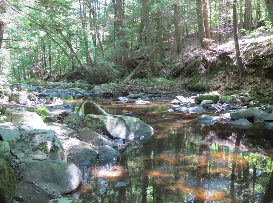
Furnace Brook is a small headwater tributary of the Housatonic River that drains about 13.3 square miles in the Cornwall, CT. The brook provides important spawning habitat for eastern brook trout, rainbow trout and brown trout. Its clean, cold water is also used by trout as a thermal refuge to escape the warmer waters of the Housatonic during the summer months. Approximately 1,000 feet upstream Fu. . . read more!
|
|
| |
|
|
|
|
|
The Connecticut SubCouncil of the Housatonic River Natural Resource Trustees provided funding to the non-profit Sharon Land Trust (SLT) to purchase a Conservation Restriction (CR) on 20.6 acres of the Frost Farm in Sharon, CT. The CR preserves two easement areas on the farm that include a kettle pond, three vernal pools, open fields, a small island, and approximately 2,742 feet of shoreline along . . . read more!
|
|
| |
|
|
|
|
|
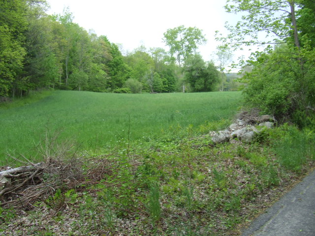
The Connecticut SubCouncil of the Housatonic River Natural Resource Trustees provided funding to the non-profit Salisbury Association Land Trust to acquire the 38.8 acre Belter property in Salisbury, CT. Located along the western shoreline of the Housatonic River, the property includes a former agricultural field containing layers of sandy, well drained loam that was deposited by hundreds of years. . . read more!
|
|
| |
|
|
|
|
|
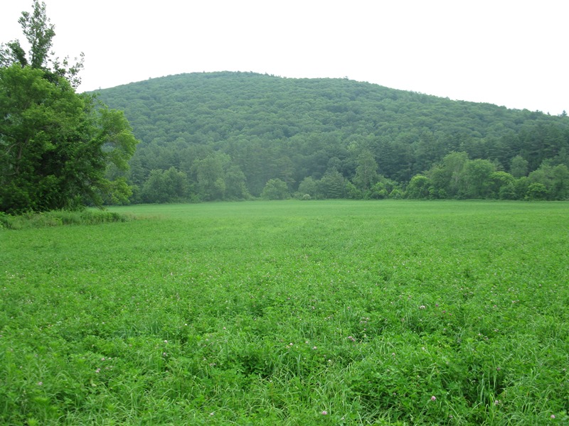
The Halfway River is a small tributary of the Housatonic River that is known for its high quality trout fishery and excellent water quality. In 2009, the Town of Newtown, CT acquired a 12-acre property with about 1,200 feet of frontage along the river to preserve and protect important riparian and aquatic habitat. To improve public access on the property, the Connecticut SubCouncil of the Housaton. . . read more!
|
|
| |
|
|
|
|
|
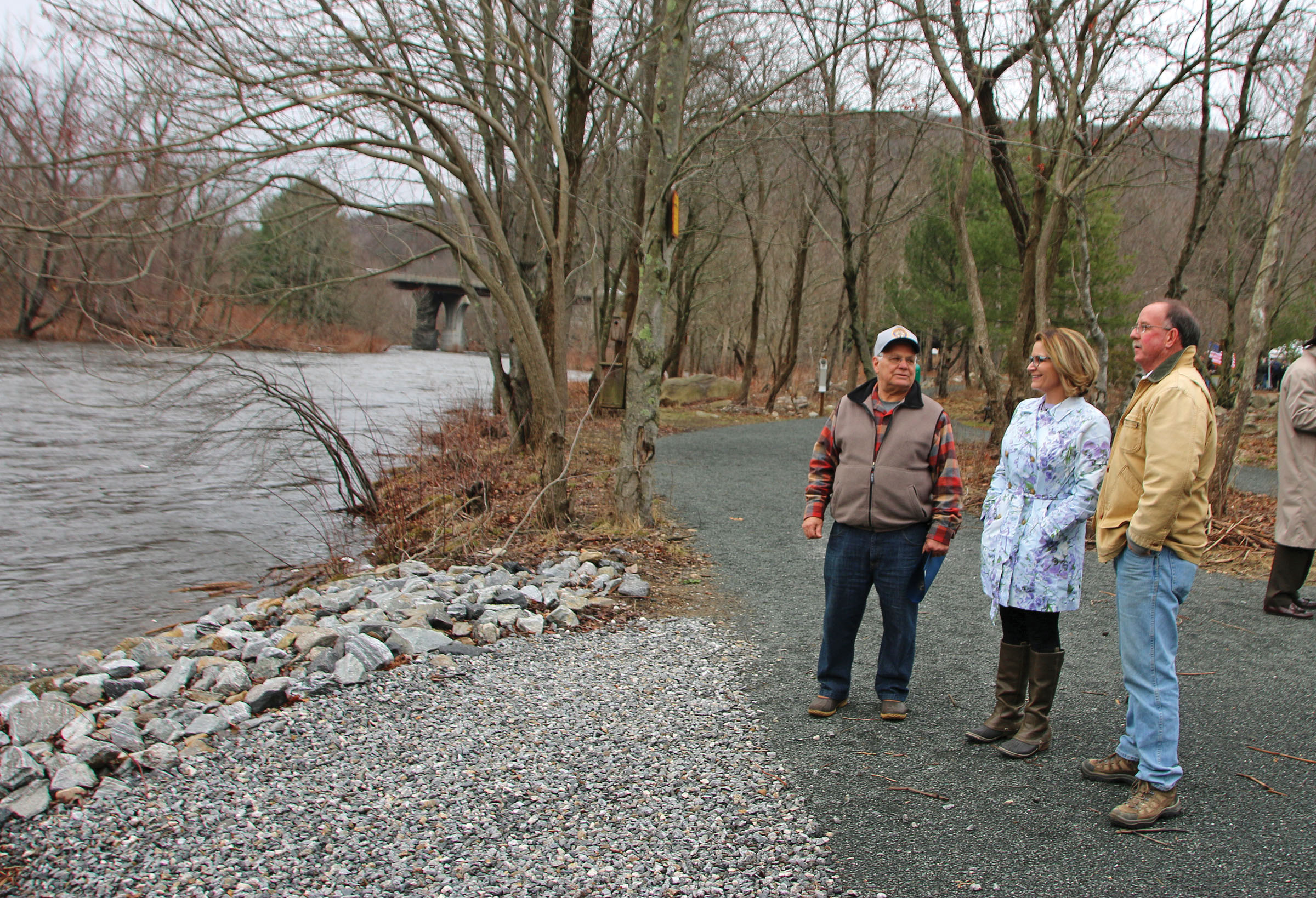
The Still River is a 25.4-mile-long tributary of the Housatonic River in western Connecticut. It is a major part of the Housatonic River Water Trail that provides access for paddlers to canoe or kayak from Danbury to the confluence with the Housatonic River at New Milford before paddling south toward the Long Island Sound. To compensate for recreational use losses, funding was provided by the Conn. . . read more!
|
|
| |
|
|
|
|
|
In 2010, the Northwest Conservation District (NCD) received $348,500 from the Connecticut SubCouncil of the Housatonic River Natural Resource Trustees to purchase, restore and develop recreational access for the 25-acre Indian Fields Preserve in New Milford, CT. Located along the Housatonic River, the acquisition protected important floodplain forest along the river. To improve the floodplain and . . . read more!
|
|
| |
|
|
|
|
|
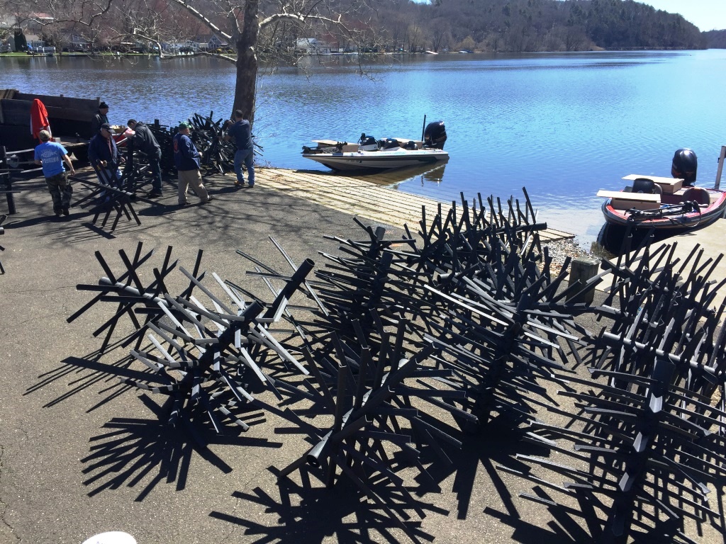
To compensate for injuries to aquatic habitats and the loss of recreational uses, Connecticut B.A.S.S. Nation (CBN) received $46,050 from the Connecticut SubCouncil of the Housatonic River Natural Resource Trustees to deploy artificial habitat structures in three impoundments along the Housatonic River. This project was intended to restore near-shore fisheries habitat and enhance recreational angl. . . read more!
|
|
| |
|
|
|
|
|
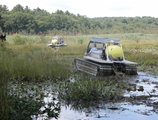
To compensate for injuries to natural resources in the Housatonic River caused by the release of polychlorinated biphenyls (PCBs) from the General Electric (GE) Pittsfield Plant in Massachusetts, the CT Department of Energy and Environmental Protection's (CT DEEP) Wetland Habitat and Mosquito Management (WHAMM) program was awarded funding for a multiyear project to restore wetlands along the lower. . . read more!
|
|